DOW-UAP-D27, Mission Report, United Arab Emirates, October 2023
Evidence media
- Official PDF: Open Sky release-file copy — eight-page MISREP PDF, SHA-256
86275421f64583566fcc32b7422c5d991b35dd7d3700e01d3fcf24b279fff243.
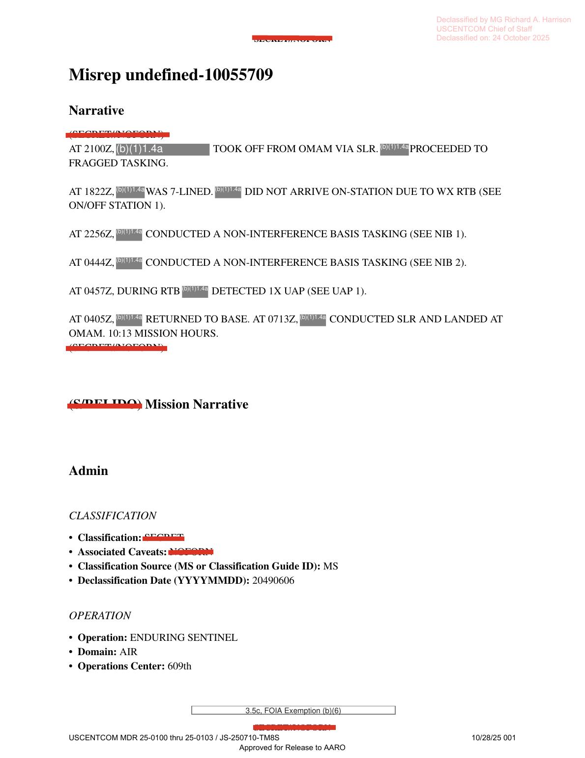 Derived page render from the official PDF, page 1: mission narrative/timeline text with redactions. This is document evidence, not object imagery.
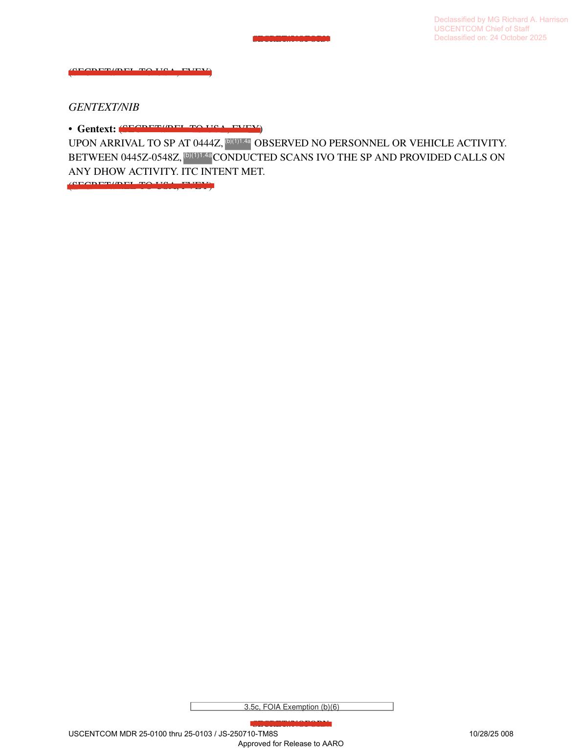
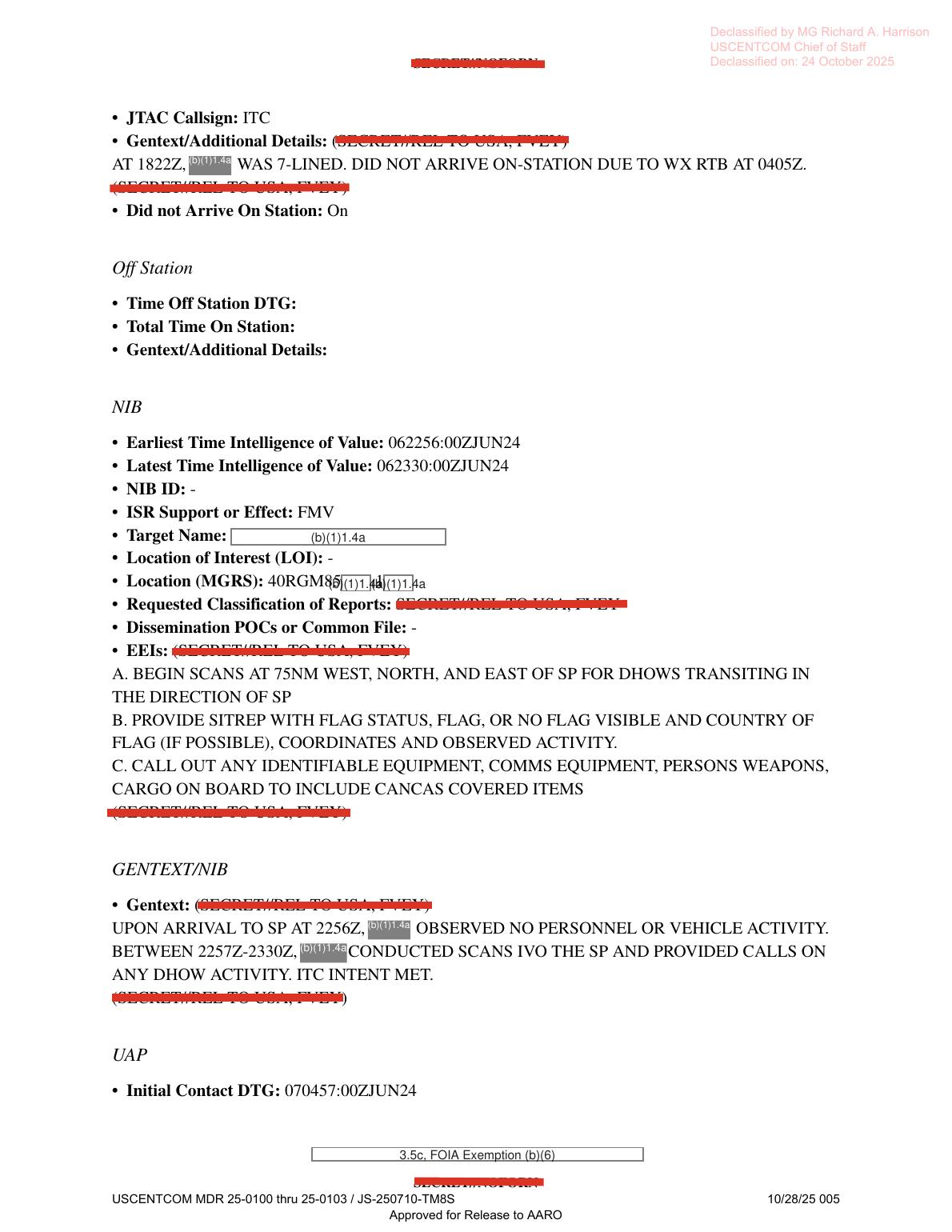 Derived page render from the official PDF, page 5: non-interference-basis FMV tasking context and the opening UAP form fields.
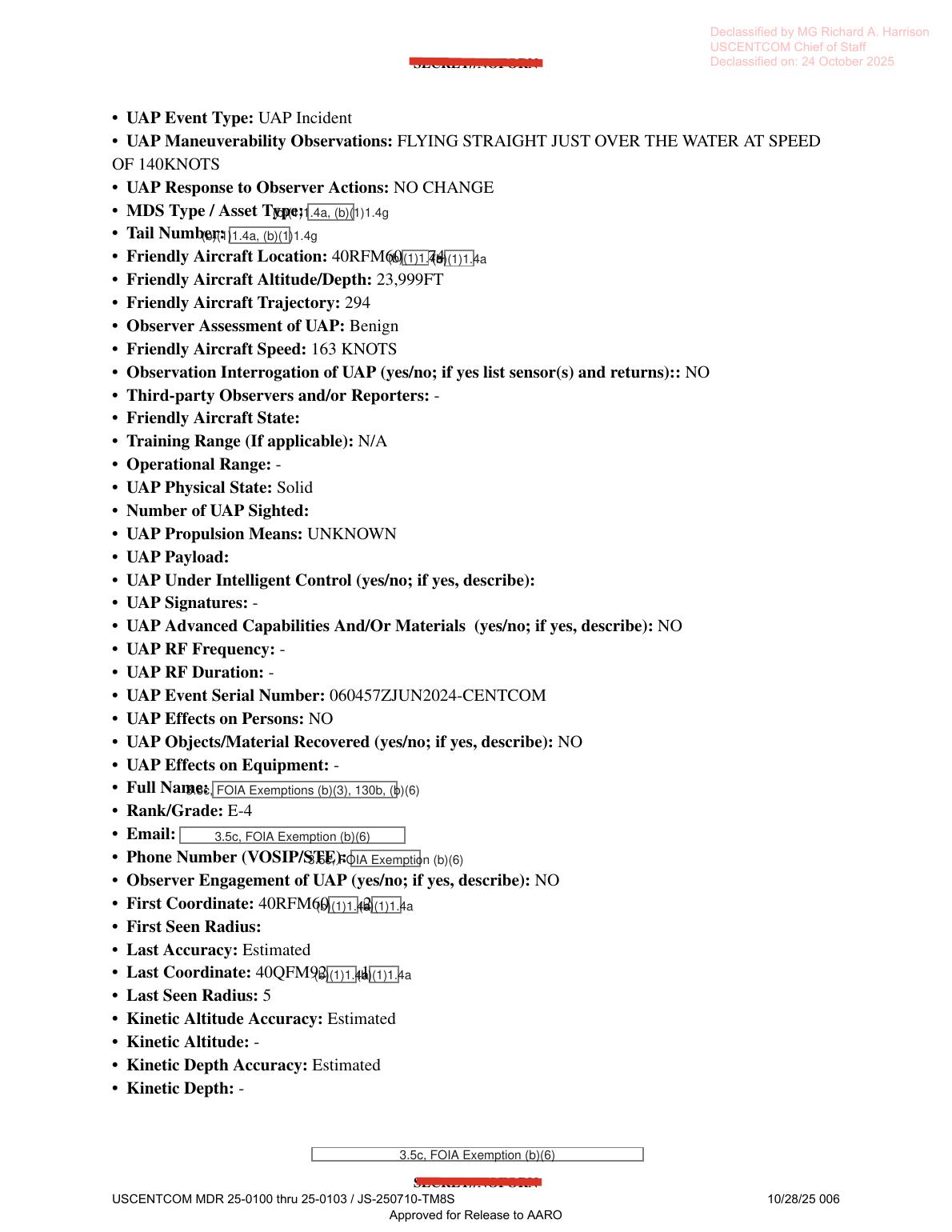 Derived page render from the official PDF, page 6: UAP form fields including observer assessment, signatures/RF/effects prompts, redacted coordinates, and no recorded observation interrogation.
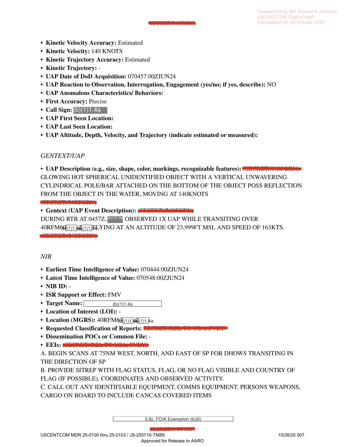 Derived page render from the official PDF, page 7: the readable description says a
 GLOWING HOT SPHERICAL UNIDENTIFIED OBJECT with a VERTICAL UNWAVERING CYLINDRICAL POLE/BAR beneath it, possibly a reflection from an object in the water, moving at 140KNOTS; a separate event line gives 23,999FT MSL and 163KTS. No object image or sensor frame is present on the page.
 Derived page render from the official PDF, page 8: later NIB/FMV tasking continuation and dhow-scanning context overlapping the UAP report window.
Investigation reading
This page treats the released file as an eight-page MISREP form packet, not as a visual exhibit or a resolved case. The verified release-file copy was checked against SHA-256 86275421f64583566fcc32b7422c5d991b35dd7d3700e01d3fcf24b279fff243; the PDF is 689,226 bytes and eight pages. Complete OCR coverage for all eight pages was reviewed, compared with the selectable PDF text layer, and all pages were rendered for visual inspection.
The rendered pages are form text with redactions and administrative markings. They do not show an embedded UAP photograph, map, radar plot, sensor still, or video frame. The most useful source reading comes from the PDF text layer plus rendered-page checks, because the OCR layer has several important transcription errors: it can read 0444Z as 0442Z, 0405Z as 0609Z, 0713Z as 0711Z, 75NM as 7NSM, AH/GMESH/SF as AH/DMESH/SF, and Mode 3/IFF 34563 as 3161.
What the file appears to contain
The file is a CENTCOM/USAF MISREP for an ISR mission under Operation ENDURING SENTINEL. The narrative states that a redacted aircraft took off from OMAM at 2100Z, proceeded to tasking, received a 7-line tasking at 1822Z, did not arrive on station because of weather/RTB, conducted non-interference-basis tasking at 2256Z, conducted another at 0444Z, and then detected 1X UAP at 0457Z during RTB. The timeline page records takeoff as 062100:00ZJUN24, landing at OMAM as 070713:00ZJUN24, engine shutdown at 070723:00ZJUN24, and total mission time as 10 hours 13 minutes.
Pages 2-4 are mostly administrative, unit, and equipment/timeline fields. The report type is MISREP, mission type is ISR, the originator/unit field reads 3 SOS, and command fields include AFSOC and USCENTCOM. Equipment prompts include radar, RWR, MWS, IRCM, ECM, chaff, flare, towed decoy, missile, gun, and weapon fields, but the rendered form shows these as blank prompts rather than populated sensor evidence. Populated equipment/context fields include one aircraft, target pod AN/DAS-1, additional avionics AH/GMESH/SF, data link LINK 16, takeoff/landing at OMAM, and Mode 3/IFF code 34563.
Pages 5 and 8 preserve two non-interference-basis FMV tasking blocks. The first has intelligence-of-value time 062256:00ZJUN24 to 062330:00ZJUN24; the second runs 070444:00ZJUN24 to 070548:00ZJUN24. Both tasking blocks ask for scans around an SP for dhows, flag status, observed activity, and identifiable equipment/persons/cargo. The later block overlaps the UAP report timing and says the crew arrived at SP at 0444Z, scanned from 0445Z-0548Z, and provided calls on dhow activity. That is operational context, not by itself an object image.
The UAP form begins at the bottom of page 5 and continues through pages 6-7. It records initial contact at 070457:00ZJUN24 and labels the event type UAP Incident. The UAP maneuverability/observation line says the object was FLYING STRAIGHT JUST OVER THE WATER AT SPEED OF 140KNOTS; the response to observer actions was NO CHANGE; observer assessment is Benign; physical state is Solid; propulsion means is UNKNOWN; signatures, RF frequency, RF duration, effects on persons, recovered materials, effects on equipment, and observer engagement are blank, dashed, or NO. The observation-interrogation field says NO, meaning the form does not record populated sensor returns in that field.
The highest-signal descriptive text is on page 7: GLOWING HOT SPHERICAL UNIDENTIFIED OBJECT WITH A VERTICAL UNWAVERING CYLINDRICAL POLE/BAR ATTACHED ON THE BOTTOM OF THE OBJECT POSS REFLECTION FROM THE OBJECT IN THE WATER, MOVING AT 140KNOTS. The adjacent event description says that during RTB at 0457Z, a redacted observer saw 1X UAP while transiting over a partially redacted 40RFM... MGRS location, FLYING AT AN ALTITUDE OF 23,999FT MSL AND SPEED OF 163KTS. This creates a source-level speed tension: the description/kinetic velocity fields say 140 knots, while the event-description and manifest summary say 163 knots. The draft should preserve that discrepancy for review rather than smoothing it into one number.
Source custody and provenance
- Official/source URL: https://www.war.gov/medialink/ufo/release_1/dow-uap-d27-mission-report-united-arab-emirates-october-2023.pdf
- Open Sky release-file copy: war-gov-dow-uap-d27-mission-report-united-arab-emirates-october-2023-3a0d83f3
- SHA-256:
86275421f64583566fcc32b7422c5d991b35dd7d3700e01d3fcf24b279fff243 - Source/container kind: PDF; verified size 689,226 bytes; verified page count 8.
- Release row: official CSV row
44; agency: Department of War. - OCR status: frontier OCR complete,
8 / 8pages with text,9OCR chunks. - The direct WAR.GOV media URL returned
403 Forbiddento both a HEAD request and a byte-range GET during verification, so this page relies on the verified release-file copy and the official URL recorded in the release metadata. - Visible declassification/release markings on the pages include
Declassified by MG Richard A. Harrison, USCENTCOM Chief of Staff,Declassified on: 24 October 2025, USCENTCOM MDR references, andApproved for Release to AARO.
There is an unresolved labeling issue in the source metadata: the title says United Arab Emirates, October 2023, while the release record gives incident date 6/7/24 and incident location Gulf of Oman, and the report text itself uses June 2024 DTGs. That should be treated as a provenance cleanup lead, not as a resolved contradiction.
Graph context
The graph has two exact official records for this item: the Release 01 CSV/landing-page record and the PDF asset record. The semantic layer currently preserves 125 extracted claims, 111 entity mentions, 7 sensor-event records, and no table rows for this asset. It also links this item near other Release 01 mission-report records such as DOW-UAP-D25 and DOW-UAP-D28.
Those graph records are useful navigation, but the rendered source review narrows what should be trusted publicly. Several sensor-event records are triggered by form prompts such as radar, RWR, IR-guided AAM, aircraft, and equipment fields. The rendered pages show most of those as blank prompts rather than populated instrument readings. The populated media/sensor context in the file is narrower: the NIB blocks list ISR Support or Effect: FMV, and the UAP observation-interrogation field says NO. No raw FMV clip, still frame, radar plot, or instrument-return table is present in this PDF.
The graph also carries OCR-derived variants that should be corrected during review or at least treated cautiously: 7NSM should read 75NM, AH/DMESH/SF should read AH/GMESH/SF, the narrative NIB 2 time should be 0444Z, and the Mode 3/IFF code should be read from the rendered/text-layer source as 34563.
Leads to check
- Reconcile the source-title/date/location mismatch: title
United Arab Emirates, October 2023versus release recordGulf of Omanand June 7, 2024 DTGs in the report. - Check whether any paired video, FMV extract, still image, or DVIDS/PR media exists for D27. The PDF itself is text only and does not provide object imagery.
- Resolve the speed discrepancy: UAP description and kinetic velocity fields say 140 knots; the event-description/manifest summary says 163 knots. Also check whether the altitude/speed line may be repeating friendly-aircraft values from the same form.
- Review the
glowing hotwording against any underlying FMV/thermal source if one is located. In this PDF, it is a text description, not a visible thermal image. - Validate the partially redacted MGRS fragments (
40RGM...,40RFM...,40QFM...) only from official source material; the released page redacts enough digits that public coordinates should not be reconstructed from this packet alone. - Keep the dhow-scanning tasking, weather RTB note, maritime operating area, and no-interrogation/no-signature fields in the prosaic/context checklist before any escalation.
Lead check notes
- Partial — title/date/location mismatch: The D27 title remains
United Arab Emirates, October 2023, while the exact release record for this page gives incident date6/7/24and incident locationGulf of Oman; the rendered PDF itself uses June 2024 DTGs. Current linked release notes carry this as a metadata mismatch, not a resolved correction. - Partial — paired media: The exact D27 PDF record does not carry a direct video pairing. The current linked corpus does contain DOW-UAP-PR29 / DVIDS
1006074, a Gulf of Oman / June 2024 video record whose official description mentions a vertical pole/bar and possible water reflection, but that video row names DOW-UAP-D8 as its accompanying mission report. Treat PR29 as a source-alignment lead until the official manifest/DVIDS mapping is reconciled; it is not embedded here as D27 evidence. - Checked — speed fields: The rendered/source text supports both speed values: the UAP maneuverability line and kinetic-velocity field say
140 KNOTS, while an adjacent event-description line says23,999FT MSLand163KTS; page 6 also labels163 KNOTSas friendly-aircraft speed. This remains a source-text tension, not one resolved value. - Blocked — thermal/FMV interpretation: The D27 PDF provides typed form text only. Its
glowing hotwording needs an officially matched video, still frame, or raw sensor excerpt before any visual interpretation can be made. - Blocked — MGRS/geography: The released pages leave
40RGM...,40RFM..., and40QFM...fragments redacted. No public coordinate should be reconstructed without an unredacted official source. - Checked — prosaic/context checklist: The same packet records weather RTB, maritime/dhow-scanning NIB/FMV tasking context, no observation interrogation, no UAP signatures, no RF field, no effects, and no engagement. Those fields are controls for later review, not a resolution.
Limits
This page is not a finding and does not adjudicate the event. The source is a redacted MISREP form; many names, callsigns, coordinates, and platform details are withheld. The PDF does not include a UAP image, map, radar plot, video frame, raw FMV, raw telemetry, or independent witness statement. The report records a subjective operator/form description and internal mission context, with no populated observation-interrogation sensor return and no recorded effects, engagement, recovered material, or RF signature.
The graph extraction is also not a substitute for source reading here. Blank equipment prompts can inflate sensor-looking records, and OCR errors can alter operational times and numeric fields. Public analysis should use the rendered source text for high-signal fields and carry the discrepancies above as review leads.
Deep investigation — graph + web reconnaissance
Source reread
The deep reread focused on the source-text layer and page renders for pages 6-7, where the UAP form is populated. Page 6 constrains the event as a UAP Incident with the object described as FLYING STRAIGHT JUST OVER THE WATER AT SPEED OF 140KNOTS, NO CHANGE in response to observer actions, observer assessment Benign, physical state Solid, propulsion UNKNOWN, and no listed signatures, RF frequency, effects on persons, recovered material, equipment effects, or observer engagement. The same page explicitly answers NO to the observation-interrogation prompt that asks for sensors and returns, so the released PDF should not be treated as an FMV/radar return package by itself.
Page 7 preserves the highest-signal descriptive line: GLOWING HOT SPHERICAL UNIDENTIFIED OBJECT WITH A VERTICAL UNWAVERING CYLINDRICAL POLE/BAR ATTACHED ON THE BOTTOM OF THE OBJECT POSS REFLECTION FROM THE OBJECT IN THE WATER, MOVING AT 140KNOTS. The adjacent event line says the observer saw 1X UAP during RTB at 0457Z, transiting over a partially redacted 40RFM... MGRS fragment, FLYING AT AN ALTITUDE OF 23,999FT MSL AND SPEED OF 163KTS. Both speed values remain source facts: the form/kinetic fields support 140 knots for the UAP, while the event-description line uses 163 knots, a number also present as the friendly-aircraft speed on page 6.
The visible coordinate and platform fields remain too redacted for public reconstruction. First/last coordinates preserve only partial 40RFM... / 40QFM... fragments, the call sign and platform identity are redacted, and multiple accuracy fields are estimated. The NIB/FMV block says the crew was scanning around an SP for dhows from 0445Z-0548Z, overlapping the 0457Z UAP line, but the PDF does not include the underlying video frame, track file, map, or sensor-return table.
Read-only graph connections
A read-only Neo4j check matched the exact PDF asset by SHA-256 and the WAR.GOV release landing-page record for CSV row 44. The asset is ingested from the official WAR.GOV PURSUE Release 01 source spine, and the semantic layer currently links it to 125 unreviewed extracted claims, 7 unreviewed sensor-event nodes, and source text chunks. Those graph records are navigation and audit material, not findings: the source reread shows that several sensor-looking graph signals are generated from form prompts, FMV tasking context, or extracted field labels rather than independent instrument evidence.
The graph also links the D27 asset to its row-44 release record and a neighboring D28 release record. A separate official DVIDS/Release 01 video record exists for DOW-UAP-PR29 / DVIDS 1006074, but there is no direct graph edge making PR29 a confirmed D27 companion. Treat any PR29 comparison as a source-alignment lead until the official row/video/mission-report mapping is reconciled.
Official web/context check
Direct WAR.GOV fetches for the release landing page and this PDF returned 403 Forbidden during this check, so the local Open Sky release-file copy remains the verified public access path for the PDF. The official DVIDS page for video 1006074, titled DOW-UAP-PR29, Unresolved UAP Report, United Arab Emirates, June 2024, was reachable and is highly relevant because its description says a 21-second IR video shows an area of contrast and says an accompanying mission report, named there as DoW-UAP-D8, described an object with a vertical pole/bar and a possible reflection from an object in the water.
That DVIDS wording closely overlaps the D27 page-7 description, but the DVIDS page names D8 rather than D27 and carries its own Release 01 row/provenance tensions. It should therefore be cited as an official media-alignment lead, not embedded as proof that the D27 PDF has a released video counterpart.
Prosaic checks and open questions
The first prosaic lane is in the source itself: POSS REFLECTION FROM THE OBJECT IN THE WATER. The event occurred in a maritime/dhow-scanning context, during an FMV NIB tasking window, after an earlier weather/RTB note, with no listed RF signature, no effects, no recovered material, no observer engagement, and no populated observation-interrogation sensor returns in the released form. Those constraints keep the case in a source-review posture rather than an escalation posture.
Robust astronomy, weather, launch, satellite, aircraft, or maritime-correlation checks are blocked by missing geometry: public fields do not provide unredacted coordinates, line of sight, range, sensor mode/polarity, field of view, platform identity, or a matched frame/time crosswalk. The next defensible step is not a conclusion; it is to reconcile whether PR29/DVIDS 1006074 is officially paired to D27, D8, or another mission report, and then compare the matched video frames against the D27 text fields if the pairing is proven.
Audit note
This section adds graph and official-web reconnaissance to the existing source read. It does not create a finding, hypothesis, or resolution decision. Machine-extracted graph claims remain unreviewed unless they are verified against the source text or media cited above.
Sources
- Department of War / WAR.GOV, Release 01 PDF asset: DOW-UAP-D27, Mission Report, United Arab Emirates, October 2023.
- Open Sky release-file copy: war-gov-dow-uap-d27-mission-report-united-arab-emirates-october-2023-3a0d83f3, SHA-256
86275421f64583566fcc32b7422c5d991b35dd7d3700e01d3fcf24b279fff243. - WAR.GOV Release 01 CSV row
44/ release landing-page record for this asset. - Source text reviewed from all eight PDF pages, including narrative/timeline pages 1 and 4, NIB pages 5 and 8, and UAP form pages 6-7.
- DVIDS, official video page: DOW-UAP-PR29, Unresolved UAP Report, United Arab Emirates, June 2024, DVIDS video
1006074.