DOW-UAP-D4, Mission Report, Arabian Gulf, 2020
Evidence media
- Official PDF: Open the verified Release 01 PDF. The release-file copy is a five-page redacted MISREP. Pages 1-4 are redaction-only in the visible PDF; page 5 contains the short
GENTEXT/UAPentry. The PDF does not contain object photographs, cockpit/sensor frames, a map, a radar plot, or video.
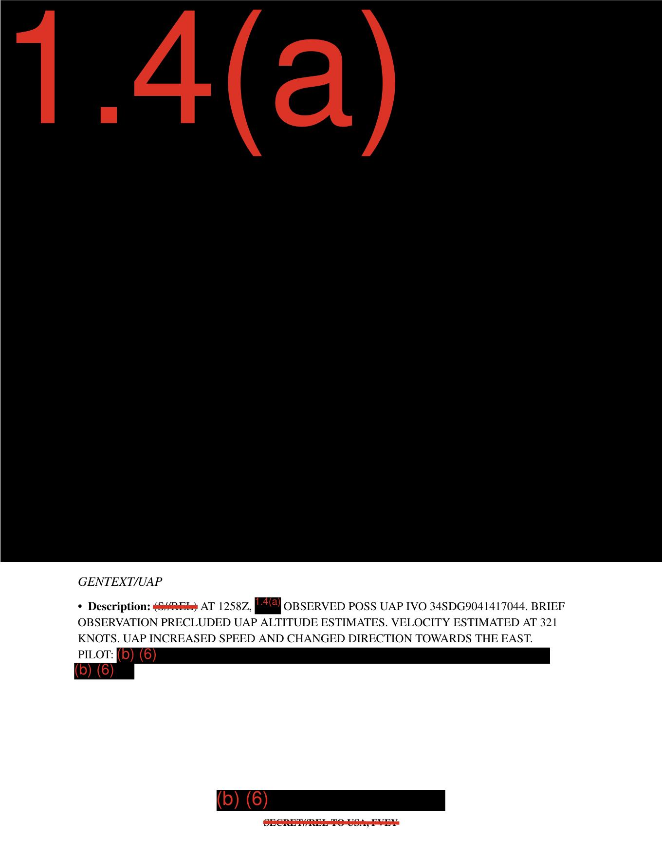
Page 5 derived render from the official PDF: a redacted GENTEXT/UAP section. Legible text reports a possible UAP observed at 1258Z near 34SDG9041417044; altitude could not be estimated; velocity was estimated at 321 KNOTS; and the object reportedly increased speed and changed direction toward the east. This is source-document context, not object imagery.
Investigation reading
This is a short, heavily redacted five-page Mission Report PDF. Four pages contain only full-page redaction coverage with the exemption marking 1.4(a). Page 5 contains the only substantive visible report text: a GENTEXT/UAP block describing a brief possible-UAP observation at 1258Z near the coordinate-like reference IVO 34SDG9041417044.
The source text says the observation was brief enough that altitude estimates were precluded. It gives an estimated velocity of 321 KNOTS and says the UAP increased speed and changed direction toward the east. The report does not include an object photo, map, radar plot, cockpit display, infrared still, video frame, or other embedded sensor image.
What the file appears to contain
| Page | Human-readable inventory |
|---|---|
| 1 | Full-page black redaction area with a large red 1.4(a) marking; no visible report body, image, map, or sensor frame. |
| 2 | Same pattern: redacted page with 1.4(a) only visible. |
| 3 | Same pattern: redacted page with 1.4(a) only visible. |
| 4 | Same pattern: redacted page with 1.4(a) only visible. |
| 5 | Upper page remains redacted under 1.4(a); lower page contains the visible GENTEXT/UAP narrative and redacted pilot-identifying fields. |
Visible page-5 text, preserving the important source wording, reads in substance: (S//REL) AT 1258Z, [redacted] OBSERVED POSS UAP IVO 34SDG9041417044. BRIEF OBSERVATION PRECLUDED UAP ALTITUDE ESTIMATES. VELOCITY ESTIMATED AT 321 KNOTS. UAP INCREASED SPEED AND CHANGED DIRECTION TOWARDS THE EAST. The PILOT: field and additional personal-identifying text are redacted under (b) (6). The bottom classification line reads SECRET//REL TO USA, FVEY.
The searchable text layer and the rendered page agree on the core observation details: 1258Z, IVO 34SDG9041417044, 321 KNOTS, no altitude estimate, and the eastward direction-change sentence. The rendered page shows the classification marking as S//REL with two slashes; one OCR pass normalized it as S/REL, so the rendered page should be preferred for that formatting detail.
Source custody and provenance
- Official URL: dow-uap-d4-mission-report-arabian-gulf-2020.pdf
- Open released file: war-gov-dow-uap-d4-mission-report-arabian-gulf-2020-4382ccbf
- Agency: Department of War
- Release: PURSUE Release 01
- Container: PDF, 5 pages, 29,121 bytes
- SHA-256:
857deb5a9363aad6e7604c828574d1f44caa0128b3ee0cb5a69204cbcd95d269 - OCR status in the available metadata: complete for 5 pages, with 5 pages carrying text markers; substantive OCR text is concentrated on page 5.
Automated direct access to the official media URL returned 403 Forbidden during this review, so the reading above uses the verified released-file copy and its matching SHA-256 hash. The PDF metadata describes it as DOW-UAP-D4, Mission Report, Arabian Gulf, 2020; the release fields list incident date and location as N/A in the row-level metadata, while the title supplies the Arabian Gulf / 2020 framing.
Graph context
Open Sky currently models this file as a Document asset and a related release-record document. The semantic graph extracted 30 claim records and 22 entity mentions from the manifest/OCR text, with no sensor-event records for this PDF. Those extracted records are useful navigation cues: they point to the observation wording, the 1258Z time, the Arabian Gulf / 2020 title context, the 321 KNOTS speed estimate, the lack of altitude estimate, and the redacted pilot fields.
A provenance cleanup lead remains: the asset metadata selected this item with one row reference, while a row-level graph record carries a DVIDS link to 1006080, which belongs to the Greece / PR34 material rather than to this D4 Arabian Gulf PDF. Treat that DVIDS/PR34 relation as a metadata-link issue unless a separate source proves an actual D4 video pairing. The PDF itself is text-only; it does not contain the PR34 video, D33 Greece pages, or D48 Air Force report material.
Leads to check
- Reconcile the release row numbering for D4 versus the row-level graph record, especially the stray DVIDS
1006080/ PR34 Greece link. - Geolocate or decode
34SDG9041417044if the coordinate system can be identified from released or related material; do not infer a precise place from the title alone. - Look for any separately released video, still image, mission annex, or sensor record tied specifically to D4 before treating the
321 KNOTSestimate as instrument-backed. - Compare the PDF's page-5 rendered text against any official transcript or CSV description if the official source republishes the file with clearer redaction metadata.
- Check whether pages 1-4 are entirely withheld body text or whether corresponding unredacted form fields exist in another release packet.
Lead check notes
- Partial — row/DVIDS mismatch: The current WAR.GOV CSV check places the D4 PDF on row
54with no DVIDS/video fields, while DVIDS1006080/ PR34 belongs to the D33 Greece record on row51and the PR34 video record on row91. Open Sky release metadata still carries a row-51relation for this asset, so PR34 should remain a metadata-link cleanup lead, not D4 evidence media. - Partial — coordinate-format check: The visible
34SDG9041417044string is compatible with an MGRS-style reading as34S DG 90414 17044; that format check points roughly to37.20°N, 20.89°E, not the Arabian Gulf. Because the PDF leaves the platform, mission context, and incident location redacted orN/A, this should stay a geospatial quality-control lead until an authoritative coordinate/source comparison is done. - Blocked — separate media or sensor record: The current linked Release 01 corpus exposes this D4 item as the PDF only. No D4-specific DVIDS ID, PR video, still image, mission annex, raw sensor record, or source page supporting the
321 KNOTSestimate as measured instrument data was found in the linked release materials. - Checked — page-5 text versus manifest summary: The release description matches the key source language about
321 KNOTS, the eastward direction change, and the caution that descriptive and estimative wording reflects the reporter's interpretation. It does not provide a clearer transcript for1258Z,34SDG9041417044, the redacted observer/platform fields, or the source of the speed estimate. - Partial — pages 1-4 withheld content: OCR and page-render checks show pages 1-4 carrying only the
1.4(a)redaction marking in the visible release-file copy. Exact D4 anchors such as34SDG9041417044and321 KNOTSappear confined to this D4 OCR text in the current linked corpus, so any unredacted form fields or companion packet would need a separate official source.
Deep investigation — graph + web reconnaissance
Source reread
The verified release-file copy is a five-page, 29,121-byte PDF with SHA-256 857deb5a9363aad6e7604c828574d1f44caa0128b3ee0cb5a69204cbcd95d269. The PDF is encrypted with copying disabled, but page rendering and OCR agree on the visible structure: pages 1-4 are fully withheld under 1.4(a), and page 5 is the only page with substantive visible text.
The page-5 render shows a GENTEXT/UAP block, not object imagery. The visible source sentence says, in substance, that at 1258Z an observer saw a possible UAP IVO 34SDG9041417044; the brief observation precluded altitude estimates; velocity was estimated at 321 KNOTS; and the UAP INCREASED SPEED AND CHANGED DIRECTION TOWARDS THE EAST. Pilot/person fields are withheld under (b)(6), and the footer reads SECRET//REL TO USA, FVEY. No map, sensor still, radar plot, cockpit display, or video frame is present in the released PDF.
Graph connections checked
Read-only Neo4j checks found the exact D4 PDF asset by canonical URL and body hash, plus the release-record row currently associated with the same body hash. The D4 asset has three text chunks: the linked-asset description, the official manifest-description chunk, and the frontier-OCR chunk. It carries 30 machine-extracted Claim nodes and chunk-supported entity mentions for the title/report ID, 1258Z, 321 knots / 369 mph, Arabian Gulf, Department of War / AARO, and redaction markers. These graph records are navigation aids only: their review status remains machine_extracted_needs_human_review / not_a_finding.
No SensorEvent node is directly attached to the exact D4 PDF asset or its current row/hash match. A text search for 34SDG9041417044 and 321 KNOTS surfaced the official frontier-OCR chunk and a secondary GitHub markdown conversion of the same page, not an independent official corroborating record. The graph still has provenance-cleanup signals: the asset retains an older related-row reference while the current CSV cache places D4 on row 54, and a stale row-level relation points DVIDS 1006080 / PR34 toward this asset even though that DVIDS page is for DOW-UAP-PR34, Unresolved UAP Report, Greece, October 2023 paired with DOW-UAP-D33.
External provenance and source checks
Direct official WAR.GOV fetches of the D4 PDF, the release CSV, the release landing page, and the release press page returned 403 Forbidden from this environment, so the evidentiary reading here relies on the verified released-file copy, stored official manifest metadata, and the rendered page derived from that verified PDF. The current cached WAR.GOV CSV row for D4 lists Incident Date: N/A, Incident Location: N/A, no DVIDS video ID, no video pairing, and the same official PDF URL.
The DVIDS negative check is important: https://www.dvidshub.net/video/1006080 resolves to DOW-UAP-PR34, Unresolved UAP Report, Greece, October 2023, and its description names the companion mission report as DoW-UAP-D33, not D4. Until an official D4-specific media page appears, PR34 should not be treated as evidence media for this Arabian Gulf D4 PDF.
Prosaic checks and open constraints
The string 34SDG9041417044 is compatible with an MGRS-style parse as 34S DG 90414 17044, roughly 37.1998°N, 20.8920°E. That format check creates a geospatial quality-control problem because the title says Arabian Gulf while the row-level date/location fields say N/A; it does not by itself establish the incident location. Without an unredacted date, platform position, altitude, bearing, sensor mode, line-of-sight geometry, weather, and sky background, astronomy, satellite, launch, aircraft, ship-light, flare, or sensor-display correlations cannot be scoped responsibly.
The first prosaic lanes remain source-custody and reporting-context checks rather than exotic escalation: confirm whether the coordinate is a true MGRS location or copied/redacted context, resolve the row/manifest mismatch, identify any missing mission annex or raw sensor record, and only then test conventional aircraft, maritime, flare, celestial, satellite, or display-artifact explanations against a real time/place geometry.
Audit note
No graph writes were made. This section preserves D4 as a source-grounded, unresolved report page: source facts and testimony are separated from unreviewed machine extraction, graph-custody cleanup leads, and prosaic-check blockers.
Limits
This page is an investigation draft, not a finding. The file provides a short redacted text statement, not an adjudicated event record. It does not show the object, does not provide altitude, does not identify the observing platform or pilot, and does not include raw sensor output. The speed and motion language are source-reported estimates and should stay separated from any later analytical interpretation until human review and source corroboration are complete.
Sources
- Department of War / PURSUE Release 01 official PDF URL: https://www.war.gov/medialink/ufo/release_1/dow-uap-d4-mission-report-arabian-gulf-2020.pdf
- Open Sky released-file copy:
/api/explore/war-gov/release-file/war-gov-dow-uap-d4-mission-report-arabian-gulf-2020-4382ccbf - SHA-256 verification:
857deb5a9363aad6e7604c828574d1f44caa0128b3ee0cb5a69204cbcd95d269 - Source text reviewed: all 5 PDF pages, rendered page images, PDF text layer, and Release 01 OCR text.