DOW-UAP-D6, Mission Report, Arabian Gulf, 2020
Evidence media
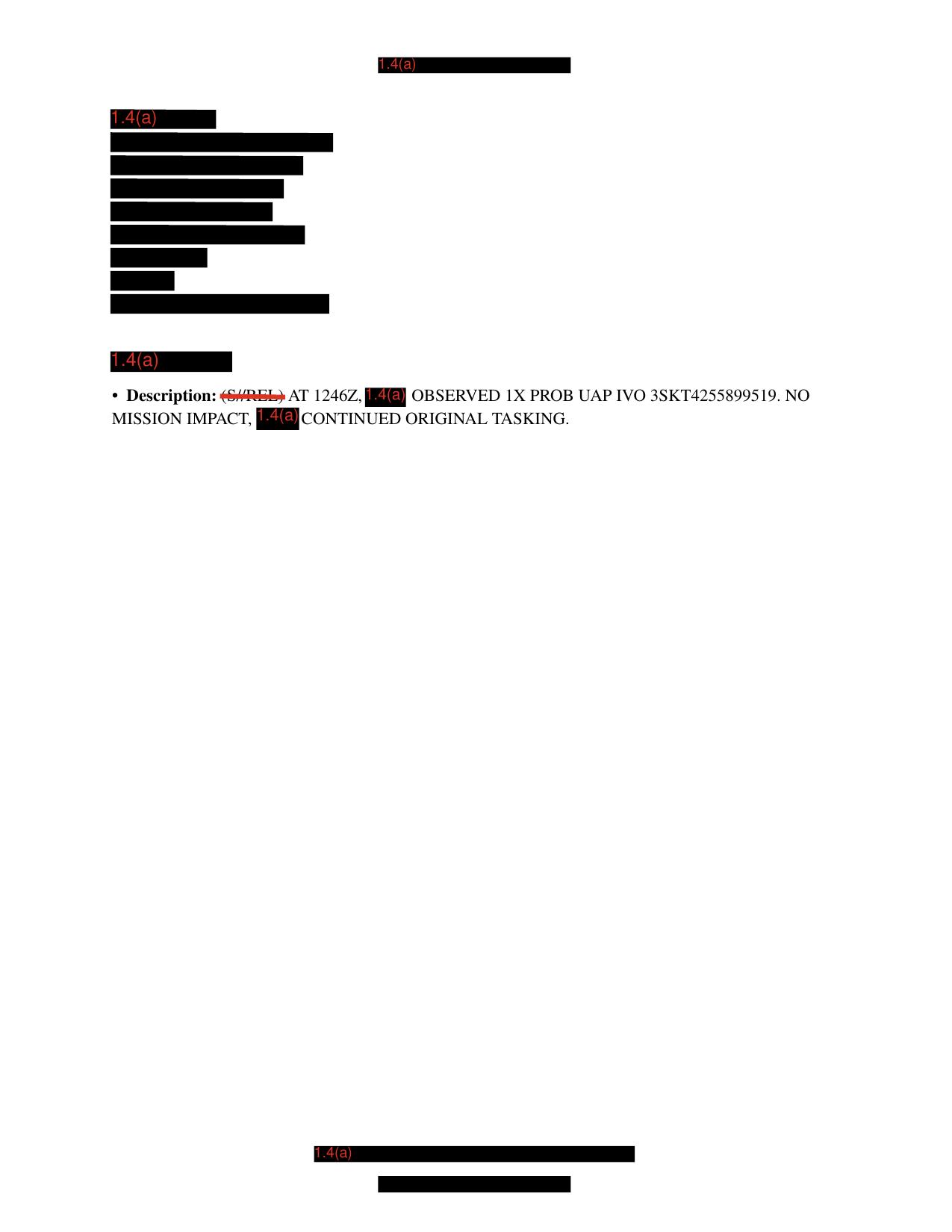
Page 7 is the only substantive visible page in the released PDF. This derived page render shows redacted MISREP text and the visible Description line reporting 1246Z, 1X PROB UAP, IVO 3SKT4255899519, and NO MISSION IMPACT; it does not show an object image, sensor frame, map, radar plot, or other visual exhibit.
Investigation reading
This is a short, heavily redacted Department of War Release 01 PDF. The file title identifies it as DOW-UAP-D6, Mission Report, Arabian Gulf, 2020, but the release-record location field attached to the asset says Pacific Ocean and the incident date is listed as N/A. That location tension is important: the draft should preserve both source fields until a curator verifies the current official CSV row and any source-system revisions.
The PDF is seven pages long and 26,847 bytes. The Open Sky release-file copy verifies against SHA-256 0f898352417d0447b3720c6eda131ac0cbe7e4cf90b8d1ceab60a431fa835457. The rendered-page pass shows pages 1-6 as full-page black redactions with only the red exemption marking 1.4(a). Page 7 is the only page with substantive visible text; it is still mostly redacted and contains no object image, map, radar plot, sensor frame, chart, or diagram.
The only high-signal source line visible in the PDF is the page-7 description:
Description: (S//REL) AT 1246Z, 1.4(a) OBSERVED 1X PROB UAP IVO 3SKT4255899519. NO MISSION IMPACT, 1.4(a) CONTINUED ORIGINAL TASKING.
That line is an observation/reporting statement, not a resolution. It gives a time (1246Z), one probable UAP, an IVO grid-like location string, no mission impact, and continuation of original tasking. It does not provide the platform, sensor, altitude, velocity, heading, weather, object shape, duration, imagery, or the identity of the redacted observer/source.
| Page range | Visual/source reading |
|---|---|
| Pages 1-6 | Full-page black redactions labeled 1.4(a). No visible report body, object photo, map, radar plot, sensor frame, or diagram. |
| Page 7 | Mostly redacted form text. Contains the one visible Description line quoted above and additional redacted blocks. No visible object imagery or technical exhibit. |
Full-document text/OCR checks found one UAP hit, one PROB hit, one OBSERVED hit, one 1246Z hit, and one NO MISSION IMPACT hit. Searches for radar, sensor, photo, video, map, image, IR, and FMV did not find supporting body text in the released OCR/text layer.
What the file appears to contain
The released file appears to be a redacted MISREP-style mission report with only one public descriptive line left visible. The visible line says that at 1246Z a redacted source observed 1X PROB UAP in the vicinity of 3SKT4255899519; the mission was not impacted, and a redacted party continued original tasking.
The public file therefore supports only a narrow source reading:
- A U.S. military reporting form exists in Release 01 for
DOW-UAP-D6. - The visible text reports one probable UAP observation at
1246Z. - The visible text includes an
IVOcoordinate/grid-like string:3SKT4255899519. - The visible text says
NO MISSION IMPACTand that original tasking continued. - The file itself does not show the object, a sensor frame, a map, a radar plot, or any unredacted platform details.
Because nearly all operational context is redacted, this page should be used as a provenance and reading aid, not as a case-resolution page. The source wording PROB UAP should remain source language; it is not a public determination by Open Sky.
Source custody and provenance
- Official/source URL: https://www.war.gov/medialink/ufo/release_1/dow-uap-d6-mission-report-arabian-gulf-2020.pdf
- Open Sky release-file route: war-gov-dow-uap-d6-mission-report-arabian-gulf-2020-f6d95562
- SHA-256:
0f898352417d0447b3720c6eda131ac0cbe7e4cf90b8d1ceab60a431fa835457 - Size / format: 26,847-byte PDF, 7 pages, PDF 1.7, AcroForm, encrypted copy restrictions reported by the PDF metadata.
- Agency: Department of War.
- Release: PURSUE / WAR.GOV Release 01.
- Release row recorded by Open Sky release metadata:
65. - Incident date field:
N/A. - Incident location field:
Pacific Ocean, while the file title and official URL sayArabian Gulf, 2020. - Review status:
graph_investigation_draft; investigation statusneeds_human_review; finding statusnot_a_finding.
The release description says this is a standardized military MISREP and that MISREPs can be used to report UAP to AARO. It also cautions that descriptive and estimative language reflects the reporter's subjective interpretation at the time. The public PDF itself is much narrower than that manifest description: most pages are redacted, and the visible body text is limited to the single page-7 description line.
Graph context
The graph has two exact source records tied to this item: a PDF-asset document for the official media URL and a release-record document for the WAR.GOV Release 01 row. The semantic graph currently lists 23 extracted claims, 17 entity mentions, zero extracted sensor events, and zero table rows for this asset. Those claim counts are navigation aids: many entries repeat the manifest language, the file title, the OCR redaction text, or the one visible description line.
No sensor events were extracted for this file, which matches the source review: the released PDF does not provide a radar return, a platform telemetry table, a raw sensor frame, a video, or an image exhibit. Related graph links include other 2020-area WAR.GOV assets such as DOW-UAP-D56, Range Fouler Debrief, Arabian Sea, August 2020 and DOW-UAP-D62, Mission Report, Strait of Hormuz, September 2020. Those links should be treated as navigational context or possible release-batch adjacency unless a human reviewer confirms a shared event, platform, time window, or source-custody relationship.
The graph also preserves a location tension. The title-derived context points to Arabian Gulf, while the release-record location field says Pacific Ocean. The page-7 text only provides IVO 3SKT4255899519 after redaction; this draft does not resolve which geography is correct.
Leads to check
- Reconcile the location metadata: title/URL
Arabian Gulfversus release-record fieldPacific Oceanversus the visibleIVO 3SKT4255899519string. - Verify whether the release row number is stable across the current WAR.GOV release metadata, mirrored metadata copies, and Open Sky indexing.
- Determine whether
3SKT4255899519is complete enough to geolocate, or whether redaction/context makes it unsafe to interpret publicly. - Check whether neighboring 2020 mission reports or range-fouler forms describe the same tasking environment, or whether their graph relationships are only batch/provenance links.
- Look for any paired source material that is not in this PDF: mission attachments, imagery, platform logs, sensor clips, or an unredacted MISREP. The released PDF itself contains none.
- Preserve
NO MISSION IMPACTas a source statement and check any operational records before treating it as a broader assessment.
Lead check notes
- Partial — location and row metadata: Open Sky release metadata and graph records both tie this PDF to release row
65; the row-level record says incident dateN/Aand locationPacific Ocean, while the title and official PDF URL sayArabian Gulf, 2020. Resolving that conflict still needs official manifest-history or corrected source-record evidence. - Partial —
3SKT4255899519geolocation: Page-7 OCR and the page render support the visibleIVO 3SKT4255899519string. Exact searches found3SKT/3SKT4255899519only in this D6 OCR within the current linked Release 01 text corpus, but the redacted report does not expose enough operational context to publish a precise location. - Checked — released media scope: The verified PDF is the only source file exposed for this row in the current release metadata, and the row-level graph record has no DVIDS URL or video title. The page render confirms that the public PDF contains redacted text only, not an object photo, sensor frame, map, radar plot, or video still.
- Partial — neighboring 2020 records: Current linked-corpus searches found
1246Zin D6 and D62,NO MISSION IMPACTin D6, D61, and D32, andPROB UAPin D6 and D74. The exact D6 grid/string combination does not appear in those other OCR files, so D56/D62-style graph links remain navigation or release-batch context unless source-page comparison proves a shared event. - Blocked — operational checks: The released PDF does not provide platform identity, unredacted coordinates, weather, flight track, raw sensor data, mission attachments, or an unredacted MISREP. Those external or still-redacted sources are required before ordinary aircraft/drone/astronomy/weather or mission-impact checks can move beyond source-reading.
- Checked —
NO MISSION IMPACTwording: The phrase is visible as source text on page 7 and should stay quoted as a report statement only; it is not enough by itself to determine object identity, severity, or resolution.
Deep investigation — graph + web reconnaissance
Source reread
A fresh source reread confirms this is still a narrow, heavily redacted MISREP source, not a visual-evidence packet. The verified Release 01 PDF is 7 pages / 26,847 bytes with SHA-256 0f898352417d0447b3720c6eda131ac0cbe7e4cf90b8d1ceab60a431fa835457; PDF metadata identifies the title as DOW-UAP-D6, Mission Report, Arabian Gulf, 2020 and reports an encrypted/copy-restricted PDF. pdfimages found no embedded images. Text extraction and the page-7 render both preserve the same single substantive line: (S//REL) AT 1246Z, 1.4(a) OBSERVED 1X PROB UAP IVO 3SKT4255899519. NO MISSION IMPACT, 1.4(a) CONTINUED ORIGINAL TASKING.
The page-7 visual review did not reveal an object image, sensor frame, map, radar plot, chart, or technical exhibit. The visible source facts are therefore limited to the redacted reporting line, the 1246Z time, the 1X PROB UAP wording, the IVO 3SKT4255899519 grid-like string, and the NO MISSION IMPACT / continued-tasking statement.
Graph connections and extraction cautions
Read-only graph checks found the exact PDF asset by URL/hash and a separate WAR.GOV Release 01 row record. The asset-side semantic extraction currently contains 23 machine-extracted Claim nodes, 17 EntityMention nodes, and 0 SensorEvent nodes for this source asset. That zero-sensor-event result matches the source reread: the public PDF does not provide a radar return, named sensor stream, telemetry table, video frame, or image exhibit.
The graph and CSV-derived records show metadata drift that should stay visible to reviewers. The current mirrored Release 01 CSV row inspected here places D6 at data row 68, with incident date N/A, incident location Pacific Ocean, and the same D6 PDF URL; older Open Sky/frontmatter and some graph relationship context still carry row 65 or neighboring D56/D62 fields. Direct RELATED_TO neighbors include D56 and D62 records, but the relationship properties and row drift indicate provenance/navigation adjacency, not proof of a shared event. A secondary UFO-USA Markdown conversion also repeats the D6 page-7 text; it is useful as a derived comparison lead only, not as canonical evidence.
Exact text searches found 3SKT4255899519 only in the D6 official OCR/text and the secondary D6 Markdown conversion. A possible expanded/corrected-looking variant, 38SKT4255899519, did not appear in the checked graph text. The visible string should therefore be quoted exactly as released and not silently geolocated or corrected.
External provenance and web reconnaissance
The canonical official PDF URL remains https://www.war.gov/medialink/ufo/release_1/dow-uap-d6-mission-report-arabian-gulf-2020.pdf. Direct WAR.GOV probes for the PDF, thumbnail, release CSV, and release landing page returned access-denied responses during this check, so the verified cached official-primary PDF bytes and hash are the custody anchor available to Open Sky. AARO and Defense.gov search probes also returned access-denied responses; a DVIDS search probe did not return a usable D6 pairing. Internet Archive availability/CDX probes for the exact PDF URL were temporarily rate-limited or unavailable.
The best external context currently comes from the release manifest description: MISREPs are standardized military mission reports, and the manifest warns that descriptive/estimative language reflects the reporter's interpretation at the time. That manifest context should not be inflated into a finding. The public PDF itself contains only the single redacted description line.
Prosaic checks, limits, and follow-up leads
Meaningful prosaic correlation is blocked by missing source data. The public release does not identify the platform, sensor mode, exact date, unredacted location, look direction, altitude, speed, weather, nearby traffic, satellite/launch context, or raw media. Because the incident date is N/A and the location fields conflict (Arabian Gulf in title/URL, Pacific Ocean in row metadata, and the redacted page's IVO 3SKT4255899519 string), astronomy/weather/traffic/satellite checks would be underconstrained and potentially misleading.
Follow-up work should prioritize: reconciling row 65 vs row 68 release metadata; determining whether the 3SKT4255899519 string is complete or redaction-truncated; obtaining any unredacted MISREP, attachments, mission logs, or media repository references; and comparing D6 only to neighboring 2020 mission reports after source-text time/location overlap is proven. This page remains not_a_finding: graph extractions are unreviewed leads, and the released source does not support an identity, hypothesis, or resolution decision.
Limits
This draft does not identify the object and does not make a finding. The released PDF is almost entirely redacted. It does not show the reported object, does not include a map or sensor frame, does not provide platform identity, does not list altitude/speed/heading, and does not provide weather or astronomy context. The only visible event-level details are 1246Z, 1X PROB UAP, IVO 3SKT4255899519, NO MISSION IMPACT, and continuation of original tasking.
Any future case-level analysis should start by resolving source custody and metadata first, then compare the visible text against any related mission reports, media exhibits, or official release-row revisions. Until then, this page remains a graph investigation draft for human review.
Sources
- Department of War / WAR.GOV Release 01 PDF: DOW-UAP-D6, Mission Report, Arabian Gulf, 2020
- Open Sky release-file route: /api/explore/war-gov/release-file/war-gov-dow-uap-d6-mission-report-arabian-gulf-2020-f6d95562
- WAR.GOV Release 01 CSV/manifest metadata for
DOW-UAP-D6. - Open Sky Release 01 semantic graph records and OCR/text extraction for this PDF asset.