DOW-UAP-PR42, Unresolved UAP Report, Middle East, 2020
Evidence media
The Open Sky release-file copy is the verified public DVIDS MP4: 274,712,045 bytes, H.264 video, 1920×1080, approximately 4:53 long, with SHA-256 049ce64e1dcd06c0b054e74c196d339b8fd2778091d82ff9d230e5c83253c0d6. The contact sheets are derived review aids from that MP4, not separate source evidence; they do not establish range, scale, speed, altitude, or object type.
Investigation reading
This draft treats PR42 as a video-source record, not as a resolved case. The reviewed source is the Release 01 DVIDS MP4 for 1006097: a 274,712,045-byte H.264 file, 1920×1080, approximately 4:53 long, with SHA-256 049ce64e1dcd06c0b054e74c196d339b8fd2778091d82ff9d230e5c83253c0d6. The decoded copy includes an AAC audio stream, but the available samples are silent.
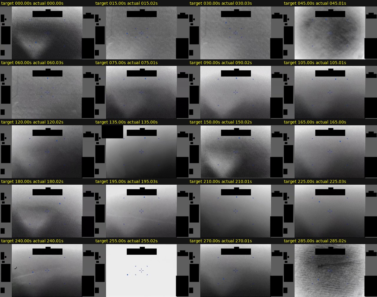
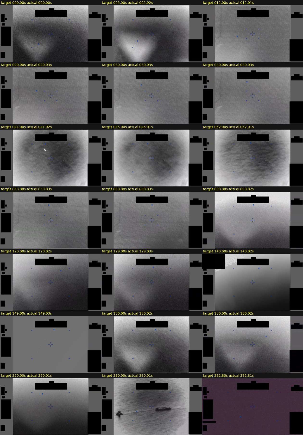
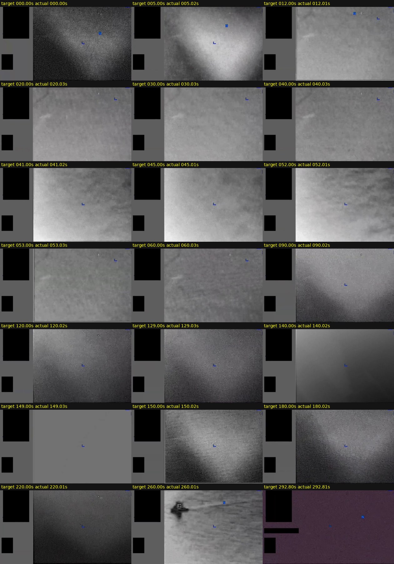
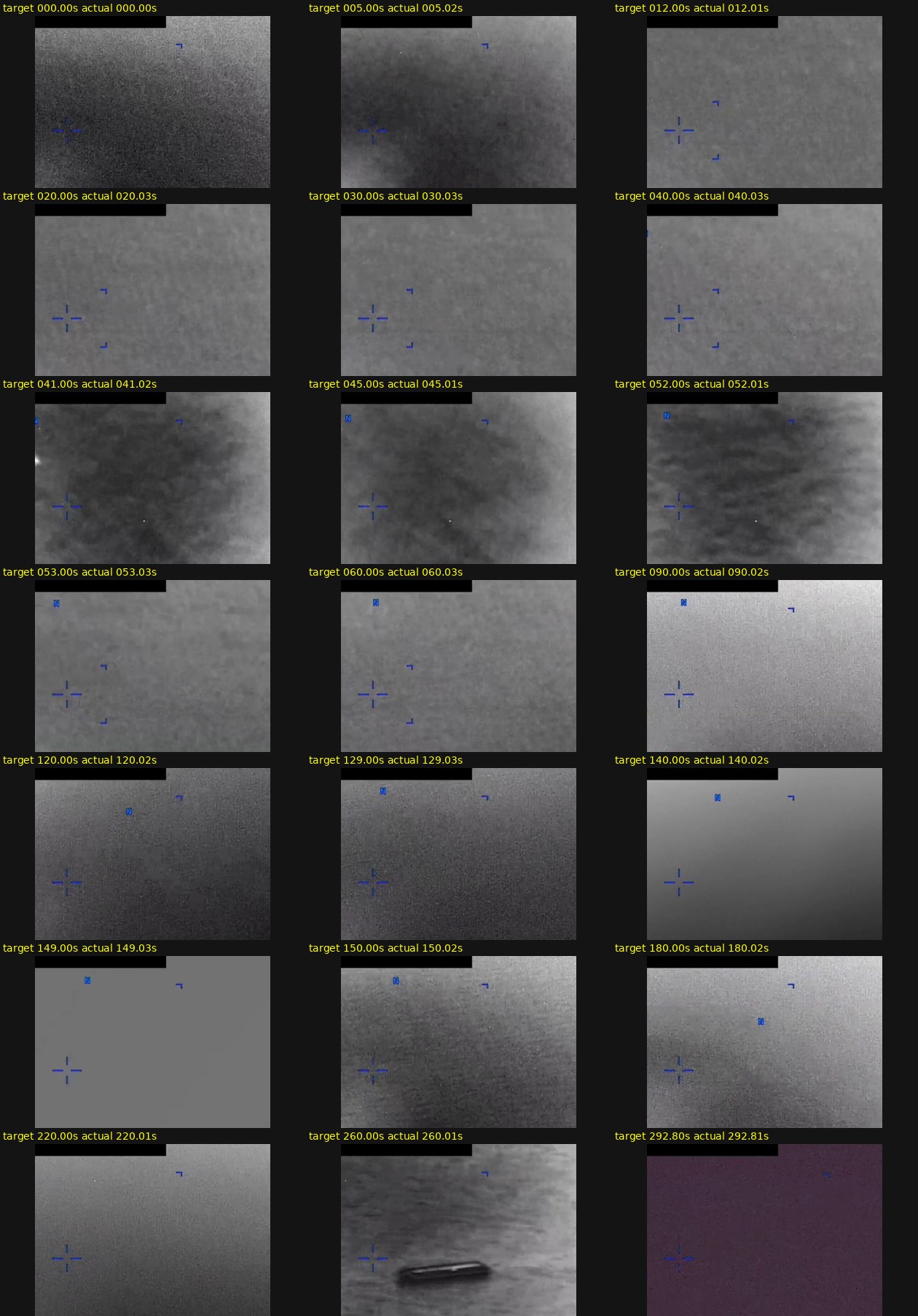
The public video is an infrared-style sensor display with heavy interface context: blue reticle/bracket symbology, black masking or redaction blocks, gray display borders, and changing imaging modes. Those overlays are not the underlying scene. Frame samples were reviewed across the full clip and at the official transition points described by DVIDS. The official source says the reporter provided no oral or written description of the observation, so the publisher's timeline is the main narrative source here.
What the file appears to contain
DVIDS describes this as a CENTCOM submission to AARO consisting of infrared sensor footage from a U.S. military platform in 2020. The incident location in the Release 01 metadata is the Arabian Gulf, while the video title uses the broader phrase “Middle East.” The DVIDS page metadata labels the video as B-roll, date taken 01.01.2020, date posted 05.08.2026 07:49, VIRIN 200102-D-D0360-6218, filename DOD_111689090, length 00:04:53, and location (UNDISCLOSED LOCATION).
The official timeline describes an “area of contrast” entering from the lower-left of the frame, intermittent loss of distinctiveness, a field-of-view narrowing around 00:41, an apparent exit near the top-left around 00:42–00:52, erratic sensor panning from 00:53 to 02:09, and two later modality switches around 02:09 and 02:30.
The frame review is consistent with a low-contrast infrared display, but the visible feature is not cleanly separable in many sampled frames. Early samples show broad diffuse bright/dark gradients and weak smudge-like contrast in the lower-left or left/center portions of the image rather than a crisp, bounded object. The 02:09–02:29 modality-switch samples show mostly gray background gradients and overlay symbology; the described contrast area is not visually strong in the sampled right-above-center crops. Later samples again show broad tonal changes, with some more visible dark/irregular contrast marks in late-frame crops, but the public MP4 alone does not support a size, range, speed, altitude, or object-type estimate.
Source custody and provenance
The public source is DVIDS video 1006097 under the title “DOW-UAP-PR42, Unresolved UAP Report, Middle East, 2020.” Open Sky's Release 01 video source metadata records the Open Sky release-file MP4 size as 274712045 bytes and the SHA-256 hash as 049ce64e1dcd06c0b054e74c196d339b8fd2778091d82ff9d230e5c83253c0d6; the reviewed release-file copy matches both values.
Release 01 metadata lists CSV row 99 for the video. The graph also has a companion release-record document anchored to a current-row URL around record 96, so row numbering should be treated as a provenance cleanup lead rather than a substantive evidence point. The official description itself cautions that the video description is informational and should not be read as an analytical judgment, investigative conclusion, or factual determination.
Open released file: Open Sky release-file MP4
Graph context
The exact graph records for this item include a VideoEvidence node for DVIDS 1006097 and a companion Release 01 Document record for the manifest/source row. The current semantic layer has 17 extracted source-text claims, 9 entity/location/time mentions, 0 extracted sensor-event records, and 0 table rows for this asset.
The extracted claim groups are mostly source metadata and publisher-description language: AARO, Department of War/DVIDS, Arabian Gulf/Middle East, the 2020 incident window, the 2026 release context, and the official descriptions of contrast-area position or motion. There are no candidate crosslinks recorded for this item. Neighbor context points to nearby Release 01 records including PR39 and PR45, which are useful for source-series comparison but are not corroboration by themselves.
Leads to check
- Compare PR42 against adjacent 2020 Middle East/Arabian Gulf Release 01 videos and records, especially PR39 and PR45, for repeated sensor-platform, masking, or description patterns.
- Locate any paired mission report, sortie log, sensor metadata, or original platform export that could provide range, pointing angle, platform movement, field-of-view, gain settings, and modality details.
- Reconcile the Release 01 row-number tension between the video metadata row
99and the graph's current-row document anchor around96. - Check ordinary traffic, maritime activity, weather/visibility, cloud/thermal background, birds, drones, debris, sensor artifacts, compression, stabilization, and display-processing explanations before escalation.
- Review the modality-switch moments with original-resolution source data if available; the public MP4 samples are too compressed and overlay-heavy for quantitative tracking.
Lead check notes
- Partial — adjacent-series comparison: Available graph context points to PR39 and PR45 as nearby Release 01 records, but PR42 does not currently have a source-backed pairing or corroborating companion record. Treat those items as same-series comparison targets only.
- Blocked — original sensor and platform context: The public release exposes the DVIDS MP4, not the original platform export, sortie log, unredacted frame set, sensor calibration, field-of-view settings, range/range-rate data, pointing geometry, or platform movement data needed for quantitative tracking.
- Partial — row and location provenance: Release 01 metadata lists video row
99and incident locationArabian Gulf; the graph release-record anchor currently points around row96, while DVIDS uses(UNDISCLOSED LOCATION)and the broader title phraseMiddle East. This remains a metadata reconciliation issue rather than evidence about the visual feature. - Partial — modality-switch review: The frame-review aids sample the publisher-described intervals, including the
02:09–02:29and02:30–04:53modality changes. The public MP4 samples remain low-contrast and overlay-heavy, so a stronger visual assessment would require original-resolution sensor data. - Needs external source — ordinary-context checks: Traffic, maritime activity, weather/visibility, cloud or thermal background, birds, drones, debris, compression, stabilization, and display-processing alternatives require exact time, coordinates, platform geometry, line of sight, and original sensor data not present in the public MP4.
Limits
This page does not assert a finding, hypothesis, or resolution. The public video has no spoken narration, no written observer report in the file, no visible independent telemetry readout beyond display symbology, and no disclosed platform geometry. Apparent motion can be affected by sensor panning, stabilization, aircraft/platform movement, field-of-view changes, contrast enhancement, compression, and masks/redactions. The derived contact sheets are review aids from the public MP4, not separate evidence.
Deep investigation — graph + web reconnaissance
Source reread and media custody
DVIDS currently serves the canonical page for video 1006097 at the PR42 URL and the short /video/1006097 URL redirects to the same canonical title. The live DVIDS page identifies the item as B-roll, VIRIN 200102-D-D0360-6218, filename DOD_111689090, length 00:04:53, date taken 01.01.2020, date posted 05.08.2026 07:49, and location (UNDISCLOSED LOCATION). The CloudFront MP4 endpoint responded to a byte-range request with 206 Partial Content and Content-Range: bytes 0-2047/274712045, matching the 274,712,045-byte release copy. The verified release-file hash remains SHA-256 049ce64e1dcd06c0b054e74c196d339b8fd2778091d82ff9d230e5c83253c0d6.
The source narrative remains publisher/manifest language rather than a witness statement: CENTCOM submitted four minutes and 53 seconds of infrared-sensor footage from a U.S. military platform to AARO, and the reporter provided no oral or written description. The timeline describes an “area of contrast” entering from the lower-left, becoming intermittent, a field-of-view narrowing at 00:41, erratic panning through 02:09, a modality switch with the contrast area right/above center from 02:09–02:29, then another modality switch through the end. DVIDS repeats the caution that the description is informational only and not an analytical judgment, investigative conclusion, or factual determination.
Representative contact-sheet reread supports a cautious visual posture. The public MP4 samples show a low-contrast infrared-style display with black masks/redactions, gray side panels, blue reticle/bracket symbology, compression/noise, broad tonal gradients, and sparse sampled frames. The lower-left and right-above-center crops show weak or diffuse contrast patterns rather than a crisp, consistently trackable object. A darker localized shape is visible in late samples around 04:20, but from the contact sheets alone it cannot be tied to range, scale, speed, object class, or independent motion.
Read-only graph check
The graph has one exact VideoEvidence record for official:video:war-pursue-uap-release:dvids-1006097, with the DVIDS canonical URL, DVIDS short URL, CloudFront MP4 URL, 274,712,045-byte full download, the same SHA-256 hash, related CSV row 99, incident location Arabian Gulf, incident date N/A, and two manifest-description text chunks. The semantic layer has 17 machine-extracted Claim nodes and 9 EntityMention nodes for this source asset, with 0 SensorEvent nodes and 0 exact CANDIDATE_CROSSLINK relationships.
Those extracted claims are useful navigation aids, not findings. They mostly restate organizations (AARO, Department of War/DVIDS), identifiers (DOW-UAP-PR42, DVIDS 1006097), broad places (Arabian Gulf, Middle East), years (2020, 2026), and the publisher's area-of-contrast timeline. Two machine claim kinds treat the informational caution as “observation” or “witness testimony”; those should remain machine_extracted_needs_human_review / not_a_finding because the source explicitly says the reporter did not provide oral or written description.
The graph also preserves a provenance-cleanup lead: an exact PR42 video node is related to a release-record Document whose row relationship is 99, but neighboring release-record document properties show row/title/final-URL drift around PR39/PR42/PR45. Stable identity for public use is therefore the exact DVIDS video ID, canonical URL, MP4 URL, file size, and SHA-256 hash, not the stale neighboring row-record title fields.
External provenance and context checks
The official DVIDS page is reachable and the DVIDS/CloudFront MP4 byte-range endpoint is reachable. Direct probes of WAR.GOV/PURSUE landing and CSV URLs, AARO search, and Defense.gov search returned 403 Forbidden from this environment; that is an access-control/custody note rather than a contradiction of the verified DVIDS and release-file copy. Internet Archive's availability endpoint reports an archived DVIDS snapshot for the exact canonical page at timestamp 20260517141439, which is a useful preservation lead but not a replacement for the current DVIDS page or the verified MP4 bytes.
No official paired mission report, sortie log, raw FMV export, sensor calibration record, or unredacted platform track was found in this check. Adjacent Release 01 items such as PR39, PR40, PR41, and PR45 remain same-series comparison records only; without a source-backed pairing they should not be treated as corroboration for PR42.
Prosaic checks and unresolved questions
The public metadata is too broad for meaningful weather, launch, satellite, astronomy, maritime, or traffic correlation. N/A incident date, broad Arabian Gulf / Middle East wording, and DVIDS (UNDISCLOSED LOCATION) do not supply the actual time, coordinates, platform, look angle, field of view, altitude, or sensor mode needed for those checks. The DVIDS 01.01.2020 date-taken field should not be used by itself to rule in or rule out prosaic sources.
The first prosaic lane remains sensor/display context: field-of-view changes, panning/stabilization, platform motion, black masks/redactions, blue symbology, modality switching, compression, gain/contrast enhancement, haze/cloud/thermal background, water or terrain texture, and possible ordinary traffic or debris. The open questions are the raw platform export, exact event time, location, line of sight, range/range-rate if any, environmental data, and whether an analyst track existed outside the public MP4.
Audit note
This page remains not_a_finding. The deep check strengthens source custody and graph provenance but does not resolve the event. The source-backed facts are the DVIDS/Release 01 video metadata, verified MP4 size/hash, the publisher's informational contrast-area timeline, and the absence of a released reporter narrative or calibration context. Machine-extracted graph claims remain unreviewed until each claim is checked against the source text or media.
Sources
- DVIDS: DOW-UAP-PR42, Unresolved UAP Report, Middle East, 2020
- DVIDS video landing page: https://www.dvidshub.net/video/1006097
- Open Sky release-file MP4: /api/explore/war-gov/release-file/war-gov-dow-uap-pr42-unresolved-uap-report-middle-east-2020-1006097
- Release 01 source dataset:
war_pursue_uap_release_2026_05_08 - Open Sky semantic dataset:
war_pursue_release01_semantic_2026_05_12